Minoria
The exact address of Minoria, the Minor’s 10-acre country estate in St. Louis County from 1854-1866, is not listed in any records. However, by using a combination of maps and surveys, we can narrow it down two plots that appear to cover the same land: 5753 Dr. Martin Luther King Drive and 5750 Theodosia (both are now empty lots that back up to one another). The full 10 acres extends beyond this to the northwest.
In the nineteenth century, plats of land in the country were not identified with numbers like buildings are, but either described as being near a landmark or by survey latitude and longitude. Contemporary newspaper accounts say Minoria was on St. Charles Road near the Six Mile House and close to Cote Brillante Street. My research* shows Minoria was on St. Charles Road southeast of Goodfellow and north of Barton.
* Other research says Minoria was the area today near Enright, Bayard, Euclid, and Fountain Avenues, just one block east of Kingshighway.
We know that Minoria was part of Lots 3 and 12 in the Cote Brillante tract (U.S. Survey No. 2976 conducted in April 1853). The deed of sale and survey plat (pictured below) give its coordinates as: “beginning at a point the southwest corner of lot 3 with the western boundary N29°40E. 31.63 links to the northwest corner of this tract. Thence S60° 20E 3.16 1/3 links to a stone the northeast corner of this tract. Thence S29°40W 31.63 links to a stake in the line dividing the lands of John Goodfellow from the lands of Hamilton R. Gamble. Thence with said line N60.20’W 3.16 1/3 links to the place of the beginning.”
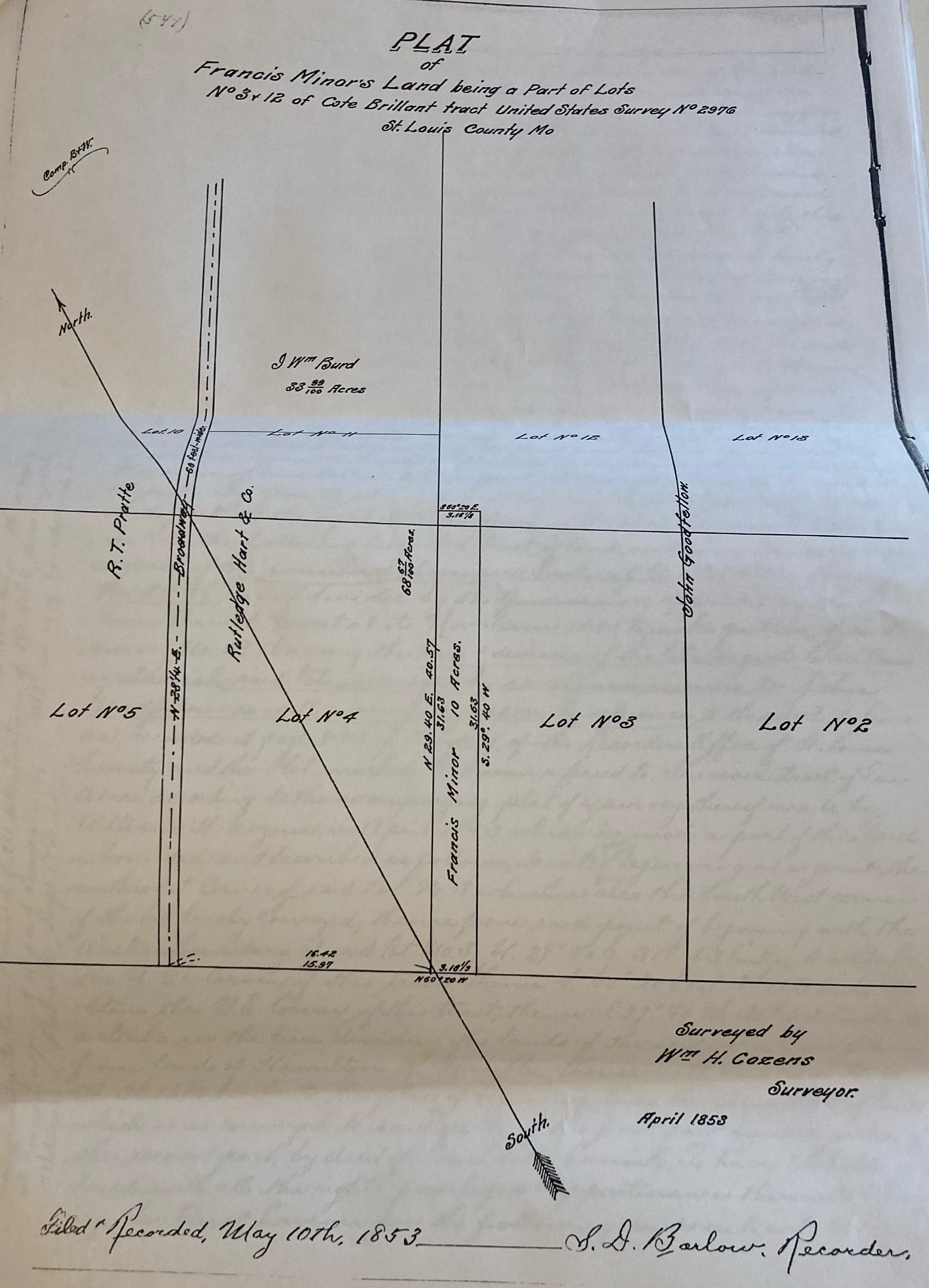
(Source: St. Louis Recorder of Deeds/Collector of Revenue)

(Source: Library of Congress)
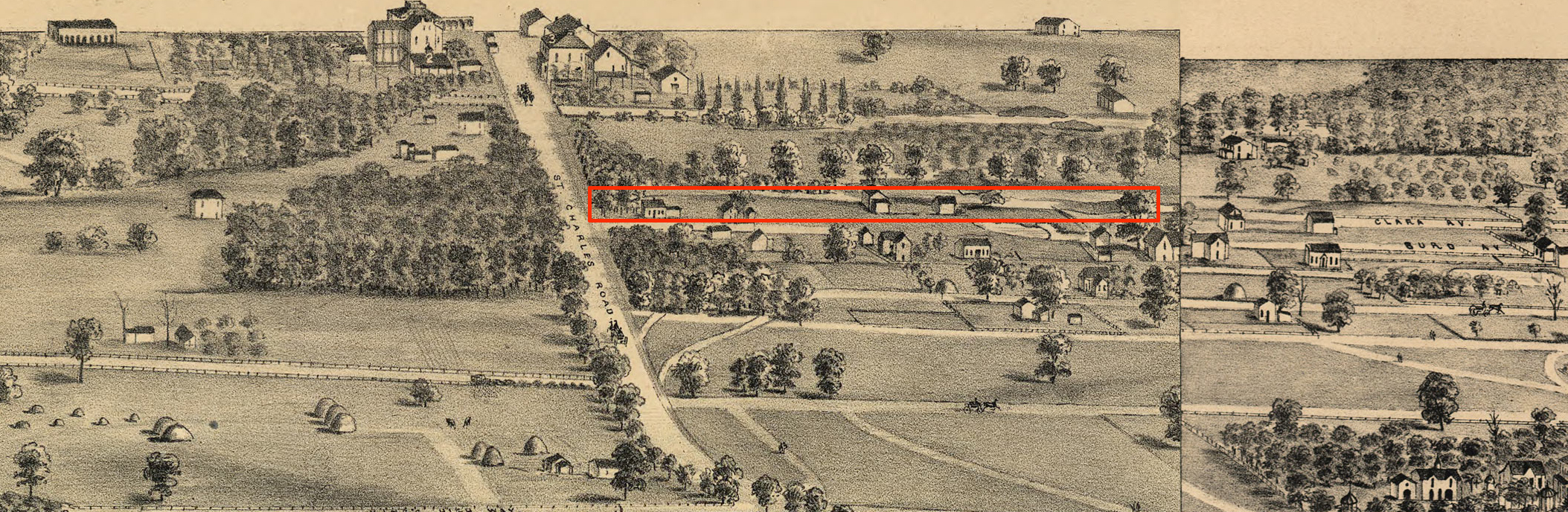
(Source: plates 103 and 104 from “Pictorial St. Louis – the Great Metropolis of the Mississippi Valley” — Compton & Company – Perspective drawings of St. Louis, Missouri.)

By the time this map was made (via hot air balloon), the Minors had moved back downtown, but this image can at least give us an idea of what the area may have looked like when they lived there.
The most likely area for Minoria is within the red box.
- The wide road in the middle is St. Charles Road.
- The Six Mile House is at the top left of St. Charles Road, marked with a 2.
- The wooded area to the left of the Six Mile House was a shooting park, possibly where Francis Gilmer Minor was when he died.
- Goodfellow is the road above the Minor property.
In the Minor’s time it was a place for the affluent, but today this is one of the most economically disadvantaged areas of St. Louis. This area is generally known as the Central West End. It appears that this area was once part of Hamilton Heights, but is today part of the Wells/Goodfellow neighborhood.

5753 Dr. Martin Luther King Drive 
5750 Theodosia

Most of the historic homes in the area have been destroyed so it is unlikely that any vestige of Minoria, once likely a grand house, remains.
Special thanks to Pruitt-Igoe Myth on Flickr for making the 1875 images available and to Dr. Glen Holt and Tom Pearson of the St. Louis Public Library for this explanation of St. Louis Streets.
